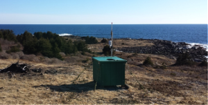
As part of its ongoing research and design efforts, Maine Aqua Ventus (MAV) has been conducting a number of studies on and around the island. This post is the first in a series in which researchers explain their studies in greater detail.

This document from the University of Maine explains the operation of a device called a LiDAR: [Right-click to save the document as a PDF file.]
Monhegan_LiDAR_Study_2014_Summary
Author: Rachael Joyce


